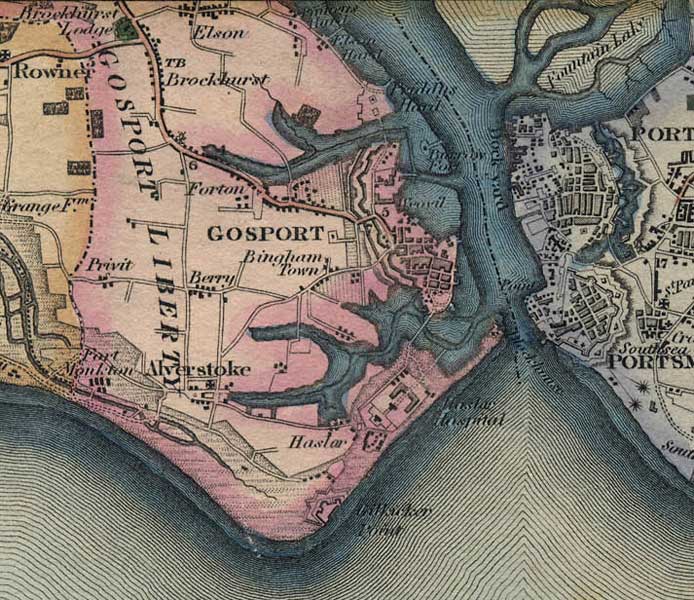
Gosport Maps Taylor's Hampshire 1759 - One of the first representations of the hospital on a map. Milne 1791 - Note the spelling of Hasler in it's original form and four sides to the building. 1826 - Now three sides to the main building and also shows St. Lukes Sheringham 1840 - a more detailed plan of the building, showing both surrounding Forts. Collins 1850 - Showing more detail of the surrounding area. Note the spelling has reverted back to Hasler. OS Map 1810-1850 Thank you to Garry Chidgey of the Fareham Archaeological Society for his help in sourcing this material